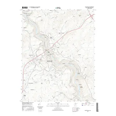
2016 Map of Fayetteville
USGS Topo · Published 2016About this map
The New River Gorge Bridge spans the canyon at the heart of this West Virginia landscape, anchoring a network of towns and trails that trace the industrial and natural history of the plateau. To the west, the concentrated residential patterns of Oak Hill and Harlem Heights show the modern growth of the county, while the smaller settlements of Lansing, Grayden, and Garten follow the high ground above the river. The canyon walls are etched with the legacy of the coal and rail era, visible in the alignment of the Chesapeake and Ohio Railway and the numerous paths like the Kaymoor Rail-Trail and Craig Branch Trail that occupy former industrial grades.
Find a feature on this map
88 named features on this map. Tap any name to fly to it.
Don’t see what you’re looking for? This feature index may not catch every label — zoom into the map to look around manually.
Map Details
Editions of this 2016 Fayetteville Map
This is the sole edition of this map. No revisions or reprints were ever made.
Other maps of this area

1887 · Hinton
USGS Topo · 1:125,000

1889 · Nicholas
USGS Topo · 1:125,000

1891 · Nicholas
USGS Topo · 1:125,000

1891 · Raleigh
USGS Topo · 1:125,000

1892 · Hinton
USGS Topo · 1:125,000

1897 · Kanawha Falls
USGS Topo · 1:125,000

1897 · Raleigh
USGS Topo · 1:125,000

1900 · Kanawha Falls
USGS Topo · 1:125,000

1901 · Nicholas
USGS Topo · 1:125,000

1901 · Kanawha Falls
USGS Topo · 1:125,000