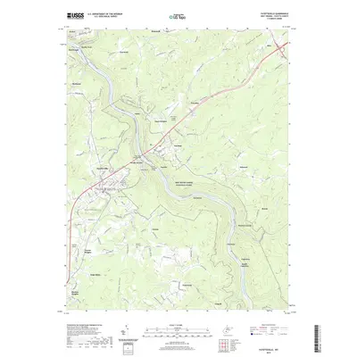
2019 Map of Fayetteville
USGS Topo · Published 2019About this map
The New River Gorge Bridge serves as the focal point of this 2019 survey, spanning the deep gorge between Fayetteville and Lansing. The landscape is dominated by the New River Gorge National River, where the New River flows past numerous smaller settlements such as Kaymoor, Fayette, and South Fayetteville. This modern topographical study illustrates the transition from the heavy industrial infrastructure of the Chesapeake and Ohio Railway along the riverbanks to the developed administrative centers of Fayetteville, featuring the Fayette County Courthouse and Fayette County Magistrate Court. Genealogy researchers can find several established burial grounds, including Huse Memorial Cem and Willis Cem, while aviation sites like the New River Gorge Airport and Fayette Airport mark the plateau above the canyon.
Find a feature on this map
146 named features on this map. Tap any name to fly to it.
Don’t see what you’re looking for? This feature index may not catch every label — zoom into the map to look around manually.
Map Details
Editions of this 2019 Fayetteville Map
This is the sole edition of this map. No revisions or reprints were ever made.
Other maps of this area

1887 · Hinton
USGS Topo · 1:125,000

1889 · Nicholas
USGS Topo · 1:125,000

1891 · Nicholas
USGS Topo · 1:125,000

1891 · Raleigh
USGS Topo · 1:125,000

1892 · Hinton
USGS Topo · 1:125,000

1897 · Kanawha Falls
USGS Topo · 1:125,000

1897 · Raleigh
USGS Topo · 1:125,000

1900 · Kanawha Falls
USGS Topo · 1:125,000

1901 · Nicholas
USGS Topo · 1:125,000

1901 · Kanawha Falls
USGS Topo · 1:125,000