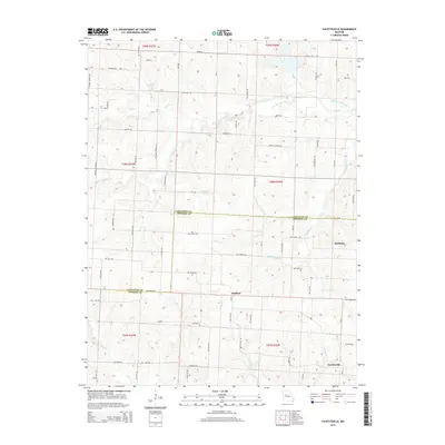
2014 Map of Fayetteville
USGS Topo · Published 2014About this map
Robbins and Fayetteville anchor this rural landscape along the border of Lafayette and Johnson Counties. The area is defined by a dense network of watercourses, including the winding Davis Cr and its bypass, the Old Channel Davis Cr. To the north, William Riech Lake and Newland Lake provide significant local landmarks among the grid of county roads. The terrain is marked by family-named routes such as Weaver School Rd and Halsey Rd, suggesting a history of localized settlement and farming. Small communities like Hoffman are connected by a systematic road grid, including Co Line Rd and various numbered routes like NW 1150th Rd, which illustrate the organized development of Missouri's agricultural heartland. This survey captures a moment where traditional land divisions meet modern rural infrastructure, with creeks like N Blackjack Cr and Walnut Cr continuing to shape the movement across the townships.
Find a feature on this map
66 named features on this map. Tap any name to fly to it.
Don’t see what you’re looking for? This feature index may not catch every label — zoom into the map to look around manually.
Map Details
Editions of this 2014 Fayetteville Map
This is the sole edition of this map. No revisions or reprints were ever made.
Other maps of this area

1885 · Warrensburg
USGS Topo · 1:125,000

1887 · Warrensburg
USGS Topo · 1:125,000

1889 · Lexington
USGS Topo · 1:125,000

1894 · Warrensburg
USGS Topo · 1:125,000

1917 · Knobnoster
USGS Topo · 1:62,500

1947 · Jefferson City
USGS Topo · 1:250,000

1949 · Mayview
USGS Topo · 1:24,000

1949 · Odessa North
USGS Topo · 1:24,000

1950 · Mayview
USGS Topo · 1:24,000

1950 · Odessa North
USGS Topo · 1:24,000