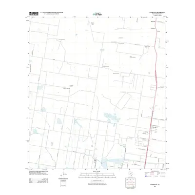
2012 Map of Faysville
USGS Topo · Published 2012About this map
Faysville and Solino anchor the eastern corridor of this South Texas landscape, where the agricultural legacy of Hidalgo County is written in a network of family ranches and essential water infrastructure. The territory is defined by its scattered windmills, such as La Morita and San Jose Windmill, which historically supported the large tracts of Jackson Pasture and the surrounding ranchlands like Serraldo Ranch and San Alfonso Ranch. These landmarks speak to the endurance of cattle and farming operations in a region where water sources like Laguna Seca, Guajolotes Enjamada, and Sapo Lake are critical features.
Find a feature on this map
57 named features on this map. Tap any name to fly to it.
Don’t see what you’re looking for? This feature index may not catch every label — zoom into the map to look around manually.
Map Details
Editions of this 2012 Faysville Map
This is the sole edition of this map. No revisions or reprints were ever made.
Other maps of this area

1939 · Linn
USGS Topo · 1:62,500

1939 · La Reforma
USGS Topo · 1:62,500

1940 · Monte Christo
USGS Topo · 1:62,500

1949 · Mc Allen
USGS Topo · 1:250,000

1954 · McAllen
USGS Topo · 1:250,000

1957 · Mc Allen
USGS Topo · 1:250,000

1962 · McAllen
USGS Topo · 1:250,000

1963 · Monte Christo
USGS Topo · 1:24,000
1963 · Hargill
USGS Topo · 1:24,000

1963 · Edinburg
USGS Topo · 1:24,000