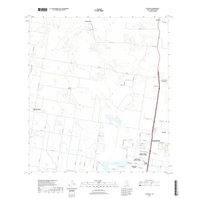
2019 Map of Faysville
USGS Topo · Published 2019About this map
Laguna Seca and Guajolotes Enramada anchor the northern landscape of this South Texas region, where the terrain transitions from open ranch land like Jackson Pasture to the expanding residential outskirts of Edinburg and McAllen. The area is marked by a distinct pattern of colonias and residential developments along the southern edge, including Monte Cristo Heights Colonia, Lake Citrus Estates Colonia, and 281 Estates Colonia.
Find a feature on this map
64 named features on this map. Tap any name to fly to it.
Don’t see what you’re looking for? This feature index may not catch every label — zoom into the map to look around manually.
Map Details
Editions of this 2019 Faysville Map
This is the sole edition of this map. No revisions or reprints were ever made.
Other maps of this area

1939 · Linn
USGS Topo · 1:62,500

1939 · La Reforma
USGS Topo · 1:62,500

1940 · Monte Christo
USGS Topo · 1:62,500

1949 · Mc Allen
USGS Topo · 1:250,000

1954 · McAllen
USGS Topo · 1:250,000

1957 · Mc Allen
USGS Topo · 1:250,000

1962 · McAllen
USGS Topo · 1:250,000

1963 · Monte Christo
USGS Topo · 1:24,000
1963 · Hargill
USGS Topo · 1:24,000

1963 · Edinburg
USGS Topo · 1:24,000