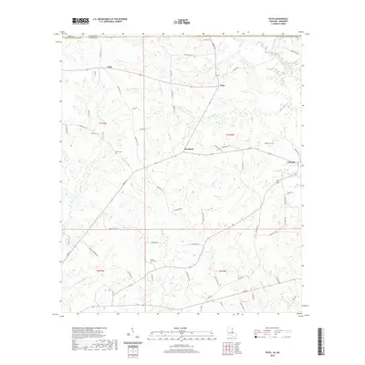
2020 Map of Felps
USGS Topo · Published 2020About this map
Woodland and Felixville anchor this detailed study of northeastern East Feliciana Parish, where the Louisiana state line meets Amite County, Mississippi. The landscape is defined by a dense network of small drainages, including Beaver Creek and Sandy Cr, that carve through the timbered uplands. The distribution of small family and community burial grounds, such as Kent Cem, Gerald Cem, and Doughty Cem, suggests a long-established pattern of rural settlement.
Find a feature on this map
75 named features on this map. Tap any name to fly to it.
Don’t see what you’re looking for? This feature index may not catch every label — zoom into the map to look around manually.
Map Details
Editions of this 2020 Felps Map
This is the sole edition of this map. No revisions or reprints were ever made.
Other maps of this area

1906 · Bayou Sara
USGS Topo · 1:125,000

1941 · Woodland
USGS Topo · 1:31,680

1941 · Norwood
USGS Topo · 1:31,680

1941 · Gilead
USGS Topo · 1:31,680

1941 · Chipola
USGS Topo · 1:31,680

1942 · Gilead
USGS Topo · 1:31,680

1945 · Norwood
USGS Topo · 1:31,680

1945 · Chipola
USGS Topo · 1:31,680

1946 · Clinton
USGS Topo · 1:31,680

1949 · Bluff Creek
USGS Topo · 1:31,680