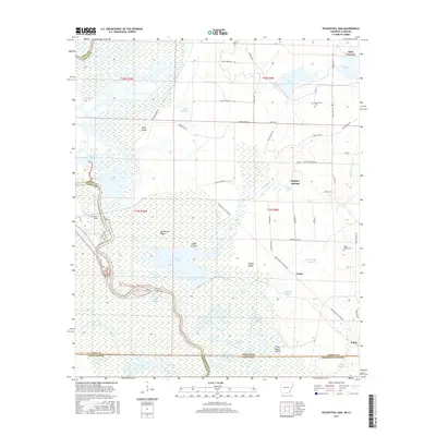
2017 Map of Felsenthal Dam
USGS Topo · Published 2017About this map
Felsenthal Dam and the surrounding Ouachita River Reservoir define this landscape along the Arkansas and Louisiana state line. The river's complex network of backwaters and sloughs includes Grand Marais, Horseshoe Slough, and the curious landmark of Rolands Raft. This environment is a maze of islands and ridges, such as Pine Island and Big Mound Ridge, that rise above the wetlands of Coffee Prairie.
Find a feature on this map
73 named features on this map. Tap any name to fly to it.
Don’t see what you’re looking for? This feature index may not catch every label — zoom into the map to look around manually.
Map Details
Editions of this 2017 Felsenthal Dam Map
This is the sole edition of this map. No revisions or reprints were ever made.
Other maps of this area

1934 · Felsenthal
USGS Topo · 1:62,500

1935 · Naff
USGS Topo · 1:62,500

1935 · Haile
USGS Topo · 1:62,500

1937 · Felsenthal
USGS Topo · 1:62,500

1938 · Felsenthal
USGS Topo · 1:62,500

1939 · Felsenthal
USGS Topo · 1:62,500

1953 · Greenwood
USGS Topo · 1:250,000

1953 · El Dorado
USGS Topo · 1:250,000

1955 · Jackson
USGS Topo · 1:250,000

1955 · Shreveport
USGS Topo · 1:250,000