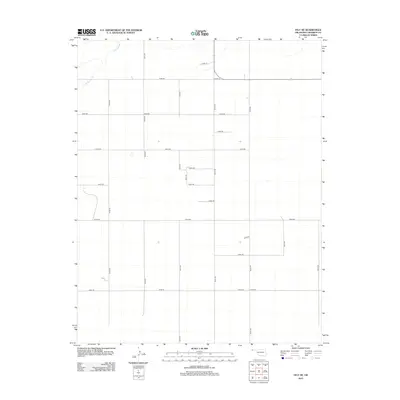
2012 Map of Felt NE
USGS Topo · Published 2012About this map
Cold Springs Cr winds through the northwest corner of this Cimarron County landscape, providing the primary natural relief in an otherwise strictly partitioned agricultural region. The terrain is defined by the rigid North American Public Land Survey System, where a network of section line roads like E0190 Rd and N0120 Rd carve the High Plains into a precise grid. This 2012 survey illustrates the enduring nature of early 20th-century land division, where rural access is maintained through an extensive system of numbered routes. Apart from the drainage of Cold Springs Cr, the area is characterized by scattered topographic depressions and a sparse collection of local infrastructure, including north-south corridors like N0100 Rd and east-west thoroughfares such as E0230 Rd. The map serves as a clear record of modern panhandle land use, where the vast geography is managed through a methodical geometry of dirt and gravel roads.
Find a feature on this map
21 named features on this map. Tap any name to fly to it.
Don’t see what you’re looking for? This feature index may not catch every label — zoom into the map to look around manually.
Map Details
Editions of this 2012 Felt NE Map
This is the sole edition of this map. No revisions or reprints were ever made.
Other maps of this area

1954 · Dalhart
USGS Topo · 1:250,000

1958 · Dalhart
USGS Topo · 1:250,000

1962 · Dalhart
USGS Topo · 1:250,000

1969 · Felt SW
USGS Topo · 1:24,000

1969 · Boise City NW
USGS Topo · 1:24,000

1969 · Boise City SW
USGS Topo · 1:24,000

1969 · Wheeless
USGS Topo · 1:24,000

1969 · Felt
USGS Topo · 1:24,000

1969 · Felt NE
USGS Topo · 1:24,000

1969 · Kenton SE
USGS Topo · 1:24,000