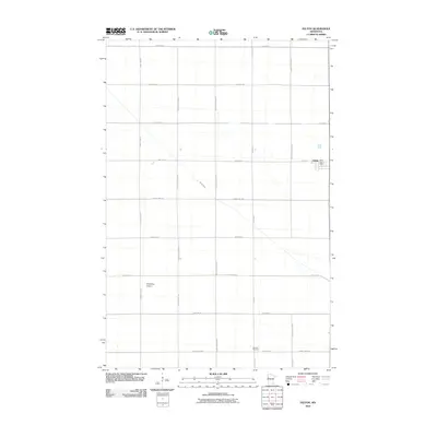
2010 Map of Felton
USGS Topo · Published 2010About this map
Felton serves as the primary hub of this Red River Valley landscape, characterized by a meticulous grid of rural roads and agricultural plots. The village itself is centered around the Felton Post Office and 7th St, showing the concentrated footprint of the community amidst the surrounding farmland. The drainage of the region is defined by the winding path of Felton Creek, which cuts a serpentine course through the straight lines of the township roads. Local infrastructure includes the Schjeldrup Airport to the southwest of town and the Scandia Cemetery located along 110th Ave N. A complex network of thoroughfares, including County Hwy-13 and County Hwy-28, facilitates movement across this flat, productive terrain during the first decade of the 21st century.
Find a feature on this map
24 named features on this map. Tap any name to fly to it.
Don’t see what you’re looking for? This feature index may not catch every label — zoom into the map to look around manually.
Map Details
Editions of this 2010 Felton Map
This is the sole edition of this map. No revisions or reprints were ever made.
Other maps of this area

1895 · Fargo
USGS Topo · 1:125,000

1897 · Fargo
USGS Topo · 1:125,000

1918 · Ulen
USGS Topo · 1:62,500

1919 · Hawley
USGS Topo · 1:62,500

1952 · Grand Forks
USGS Topo · 1:250,000

1953 · Fargo
USGS Topo · 1:250,000

1956 · Fargo
USGS Topo · 1:250,000

1956 · Grand Forks
USGS Topo · 1:250,000

1964 · Dilworth
USGS Topo · 1:24,000
1964 · Glyndon North
USGS Topo · 1:24,000