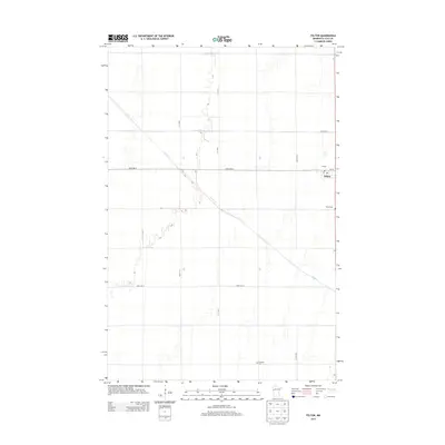
2013 Map of Felton
USGS Topo · Published 2013About this map
Felton serves as the primary settlement hub in this part of Clay County, situated at the junction of 7th St and several key rural avenues. The landscape is defined by the precise grid of agricultural transport routes, including 170th Ave N and 160th Ave N, which partition the fertile Red River Valley terrain. Local history and genealogy are anchored by the presence of Felton Cem and Scandia Cem, providing significant points of reference for researchers tracing family roots in the region. Meandering through this structured township layout is Felton Cr, the area's primary drainage, which cuts a diagonal path across the rectilinear sections. The small downtown core of Felton is marked by essential community infrastructure, most notably the Po, reflecting the town's role as a local service center for the surrounding farming community.
Find a feature on this map
12 named features on this map. Tap any name to fly to it.
Don’t see what you’re looking for? This feature index may not catch every label — zoom into the map to look around manually.
Map Details
Editions of this 2013 Felton Map
This is the sole edition of this map. No revisions or reprints were ever made.
Other maps of this area

1895 · Fargo
USGS Topo · 1:125,000

1897 · Fargo
USGS Topo · 1:125,000

1918 · Ulen
USGS Topo · 1:62,500

1919 · Hawley
USGS Topo · 1:62,500

1952 · Grand Forks
USGS Topo · 1:250,000

1953 · Fargo
USGS Topo · 1:250,000

1956 · Fargo
USGS Topo · 1:250,000

1956 · Grand Forks
USGS Topo · 1:250,000

1964 · Dilworth
USGS Topo · 1:24,000
1964 · Glyndon North
USGS Topo · 1:24,000