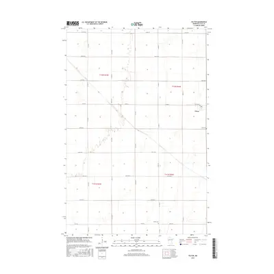
2016 Map of Felton
USGS Topo · Published 2016About this map
Felton serves as the primary hub of this section of Clay County, situated along the intersection of major transit corridors like Co Hwy 73 and 160 Ave N. The landscape is defined by the rigid geometry of the Public Land Survey System, with township lines for t142n r47w and t142n r46w organizing the agricultural plains. Felton Creek provides a natural break in the grid, winding through the western sections near Co Rd 106. For those researching local families, the map identifies the Felton Cem just east of the main settlement and Scandia Cem to the south along Co Rd 28. The distribution of section lines and county roads reflects a mature farming region where the infrastructure is tightly integrated with the land divisions.
Find a feature on this map
28 named features on this map. Tap any name to fly to it.
Don’t see what you’re looking for? This feature index may not catch every label — zoom into the map to look around manually.
Map Details
Editions of this 2016 Felton Map
This is the sole edition of this map. No revisions or reprints were ever made.
Other maps of this area

1895 · Fargo
USGS Topo · 1:125,000

1897 · Fargo
USGS Topo · 1:125,000

1918 · Ulen
USGS Topo · 1:62,500

1919 · Hawley
USGS Topo · 1:62,500

1952 · Grand Forks
USGS Topo · 1:250,000

1953 · Fargo
USGS Topo · 1:250,000

1956 · Fargo
USGS Topo · 1:250,000

1956 · Grand Forks
USGS Topo · 1:250,000

1964 · Dilworth
USGS Topo · 1:24,000
1964 · Glyndon North
USGS Topo · 1:24,000