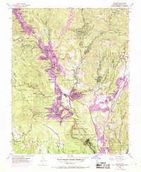
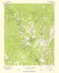
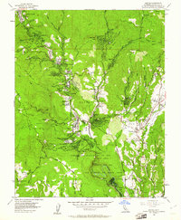
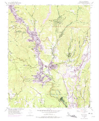
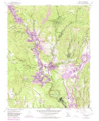
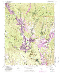
1955 Map of Felton
USGS Topo · Published 1969About this map
The San Lorenzo River winds through the Santa Cruz Mountains, anchoring a string of timber and resort communities that flourished in the mid-20th century. This survey documents the expansion of Felton and Ben Lomond during the late 1960s, a period of transition where the historical sawmill and logging economy began to integrate with suburban growth. The map highlights significant cultural sites such as Mount Hermon, several summer camps including Mt Cross Camp and Camp Waxibe, and the vast Henry Cowell Redwoods State Park.
Find a feature on this map
79 named features on this map. Tap any name to fly to it.
Don’t see what you’re looking for? This feature index may not catch every label — zoom into the map to look around manually.
Map Details
Editions of this 1955 Felton Map
6 editions found
Other maps of this area

1902 · Santa Cruz
USGS Topo · 1:125,000

1912 · Capitola
USGS Topo · 1:62,500

1914 · Capitola
USGS Topo · 1:62,500

1916 · New Almaden
USGS Topo · 1:48,000

1919 · New Almaden
USGS Topo · 1:62,500
1940 · Capitola
USGS Topo · 1:62,500

1940 · Los Gatos
USGS Topo · 1:62,500

1943 · Los Gatos
USGS Topo · 1:62,500

1947 · San Francisco
USGS Topo · 1:250,000

1947 · San Jose
USGS Topo · 1:250,000