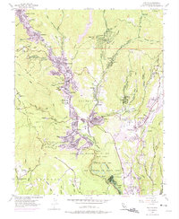
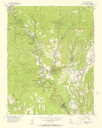
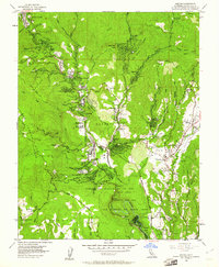
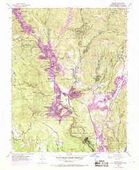
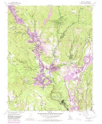
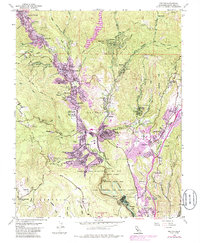
1955 Map of Felton
USGS Topo · Published 1975About this map
The San Lorenzo River valley serves as the central artery for this mountainous region of the Santa Cruz Mountains, where dense redwood groves meet mid-century residential growth. Communities like Ben Lomond and Boulder Creek follow the river's winding path, while the southern portion of the map is dominated by the sprawling Henry Cowell Redwoods State Park. The landscape is a complex network of steep ridges like Ben Lomond Mountain and narrow gulches, such as Lockhart Gulch and Gold Gulch, revealing an area defined by its timber heritage and emerging recreational appeal. Notable local landmarks include educational centers like Alba Sch and the San Lorenzo Valley High School, alongside established camps such as Mount Hermon and Camp Wasibo. The presence of the Southern Pacific railroad line and various quarries and sand pits indicates the continuing industrial utility of the terrain during this era of suburban expansion.
Find a feature on this map
82 named features on this map. Tap any name to fly to it.
Don’t see what you’re looking for? This feature index may not catch every label — zoom into the map to look around manually.
Map Details
Editions of this 1955 Felton Map
6 editions found
Other maps of this area

1902 · Santa Cruz
USGS Topo · 1:125,000

1912 · Capitola
USGS Topo · 1:62,500

1914 · Capitola
USGS Topo · 1:62,500

1916 · New Almaden
USGS Topo · 1:48,000

1919 · New Almaden
USGS Topo · 1:62,500
1940 · Capitola
USGS Topo · 1:62,500

1940 · Los Gatos
USGS Topo · 1:62,500

1943 · Los Gatos
USGS Topo · 1:62,500

1947 · San Francisco
USGS Topo · 1:250,000

1947 · San Jose
USGS Topo · 1:250,000