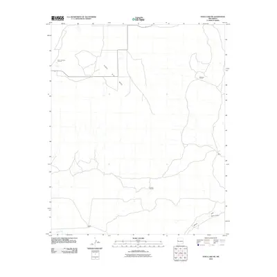
2010 Map of Fence Lake SW
USGS Topo · Published 2010About this map
Santa Rita Mesa dominates this western Cibola County landscape, where the pattern of water resource management defines the settlement of the high desert. This 2010 survey documents a ranching infrastructure heavily dependent on strategically placed water sources, including the isolated Semi Lonesome Windmill, Medanoso Windmill, and Escojeda Windmill. The presence of the Cox Ranch and the Carter Well suggests a continuity of land use in a region where surface water is scarce, primarily limited to ephemeral drainages. The topography is carved by significant channels like Nations Draw and Tejana Draw in the southeast, while Largo Creek skims the southwestern corner. These features reflect the arid environmental challenges and the sparse, utilitarian nature of human habitation in the Fence Lake area during the early 21st century.
Find a feature on this map
9 named features on this map. Tap any name to fly to it.
Don’t see what you’re looking for? This feature index may not catch every label — zoom into the map to look around manually.
Map Details
Editions of this 2010 Fence Lake SW Map
This is the sole edition of this map. No revisions or reprints were ever made.
Other maps of this area

1954 · Saint Johns
USGS Topo · 1:250,000

1957 · Saint Johns
USGS Topo · 1:250,000

1958 · Saint Johns
USGS Topo · 1:250,000

1962 · Saint Johns
USGS Topo · 1:250,000

1972 · Zuni Salt Lake
USGS Topo · 1:24,000

1972 · Lake Armijo
USGS Topo · 1:24,000

1972 · Fence Lake
USGS Topo · 1:24,000

1972 · Tejana Mesa
USGS Topo · 1:24,000
1972 · Cerro Prieto
USGS Topo · 1:24,000

1972 · Fence Lake SW
USGS Topo · 1:24,000