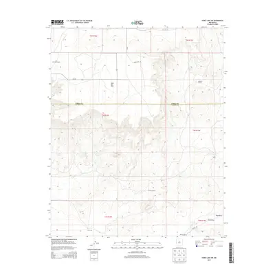
2013 Map of Fence Lake SW
USGS Topo · Published 2013About this map
Santa Rita Mesa dominates this western New Mexico landscape, straddling the high plateau between the Cibola and Catron county lines. The environment is defined by its vital water sources, with distinct points of historical interest such as Old Santa Rita Springs and New Santa Rita Springs nestled along the slopes. In a region where reliable water dictated the success of ranching operations, family-named landmarks and infrastructure like the Cox Ranch, Escojeda Windmill, and Carter Well illustrate the scale of land use in the early 21st century.
Find a feature on this map
24 named features on this map. Tap any name to fly to it.
Don’t see what you’re looking for? This feature index may not catch every label — zoom into the map to look around manually.
Map Details
Editions of this 2013 Fence Lake SW Map
This is the sole edition of this map. No revisions or reprints were ever made.
Other maps of this area

1954 · Saint Johns
USGS Topo · 1:250,000

1957 · Saint Johns
USGS Topo · 1:250,000

1958 · Saint Johns
USGS Topo · 1:250,000

1962 · Saint Johns
USGS Topo · 1:250,000

1972 · Zuni Salt Lake
USGS Topo · 1:24,000

1972 · Lake Armijo
USGS Topo · 1:24,000

1972 · Fence Lake
USGS Topo · 1:24,000

1972 · Tejana Mesa
USGS Topo · 1:24,000
1972 · Cerro Prieto
USGS Topo · 1:24,000

1972 · Fence Lake SW
USGS Topo · 1:24,000