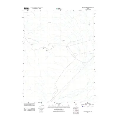
2011 Map of Fencemaker Pass
USGS Topo · Published 2011About this map
Fencemaker Pass and its surrounding canyons define this stretch of Nevada’s basin and range country as it was documented in 2011. The landscape is marked by steep elevation changes, with Fencemaker Canyon and Old Man Canyon cutting through the terrain. The presence of Spring Creek in the southeastern portion of the map suggests a rare source of water in this arid region, which traditionally served as a vital resource for early livestock operations and traveler routes through the Fencemaker area. Gamble Basin sits just south of the pass, showing the natural bowl-like features of the high desert. This topographic survey captures the sparse network of unpaved roads and the essential drainage patterns, like Sou Canyon, that have historically influenced movement through these remote gaps in the mountains.
Find a feature on this map
7 named features on this map. Tap any name to fly to it.
Don’t see what you’re looking for? This feature index may not catch every label — zoom into the map to look around manually.
Map Details
Editions of this 2011 Fencemaker Pass Map
This is the sole edition of this map. No revisions or reprints were ever made.
Other maps of this area

1932 · Sonoma Range
USGS Topo · 1:250,000

1939 · Sonoma Range
USGS Topo · 1:250,000

1955 · Millett
USGS Topo · 1:250,000

1955 · Winnemucca
USGS Topo · 1:250,000

1958 · Winnemucca
USGS Topo · 1:250,000

1959 · Millett
USGS Topo · 1:250,000

1961 · Cain Mountain
USGS Topo · 1:62,500

1961 · Fencemaker
USGS Topo · 1:62,500

1962 · Winnemucca
USGS Topo · 1:250,000

1966 · Humboldt Salt Marsh
USGS Topo · 1:62,500