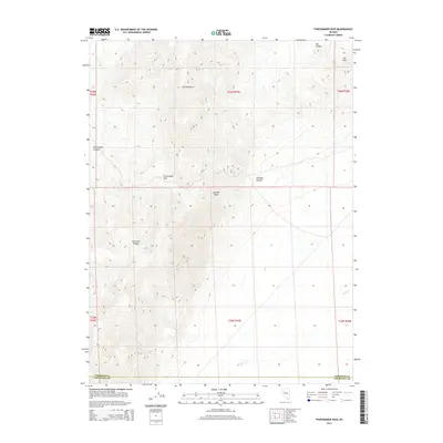
2014 Map of Fencemaker Pass
USGS Topo · Published 2014About this map
The high ridges of the Stillwater Range dominate this Nevada landscape, where the rugged terrain transitions across the boundary of Pershing and Churchill counties. Named for the historical activity in the area, Fencemaker Pass and Fencemaker Canyon serve as central landmarks within this high-desert environment. The map details a complex drainage system, where seasonal flows like Spring Cr have carved out features such as Gamble Basin and Old Man Canyon. To the northeast, the terrain softens into the Sou Hills near Sou Canyon, offering a detailed look at the public land survey system markers and elevation contours that define this remote section of the Great Basin.
Find a feature on this map
9 named features on this map. Tap any name to fly to it.
Don’t see what you’re looking for? This feature index may not catch every label — zoom into the map to look around manually.
Map Details
Editions of this 2014 Fencemaker Pass Map
This is the sole edition of this map. No revisions or reprints were ever made.
Other maps of this area

1932 · Sonoma Range
USGS Topo · 1:250,000

1939 · Sonoma Range
USGS Topo · 1:250,000

1955 · Millett
USGS Topo · 1:250,000

1955 · Winnemucca
USGS Topo · 1:250,000

1958 · Winnemucca
USGS Topo · 1:250,000

1959 · Millett
USGS Topo · 1:250,000

1961 · Cain Mountain
USGS Topo · 1:62,500

1961 · Fencemaker
USGS Topo · 1:62,500

1962 · Winnemucca
USGS Topo · 1:250,000

1966 · Humboldt Salt Marsh
USGS Topo · 1:62,500