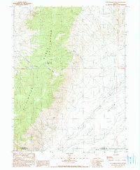
1990 Map of Fencemaker Pass
USGS Topo · Published 1990About this map
Stillwater Range peaks dominate the western landscape of this Great Basin quadrangle, descending into the broad expanse of Dixie Valley to the east. The terrain is marked by a legacy of mineral exploration, evidenced by numerous prospects, a Shaft Mine, and the specifically named Gilberts Mine. These sites, along with an Open Pit Mine and various Adit Shaft markings, suggest a history of small-scale extraction and prospecting across the high slopes.
Find a feature on this map
19 named features on this map. Tap any name to fly to it.
Don’t see what you’re looking for? This feature index may not catch every label — zoom into the map to look around manually.
Map Details
Editions of this 1990 Fencemaker Pass Map
This is the sole edition of this map. No revisions or reprints were ever made.
Other maps of this area

1932 · Sonoma Range
USGS Topo · 1:250,000

1939 · Sonoma Range
USGS Topo · 1:250,000

1955 · Millett
USGS Topo · 1:250,000

1955 · Winnemucca
USGS Topo · 1:250,000

1958 · Winnemucca
USGS Topo · 1:250,000

1959 · Millett
USGS Topo · 1:250,000

1961 · Cain Mountain
USGS Topo · 1:62,500

1961 · Fencemaker
USGS Topo · 1:62,500

1962 · Winnemucca
USGS Topo · 1:250,000

1966 · Humboldt Salt Marsh
USGS Topo · 1:62,500