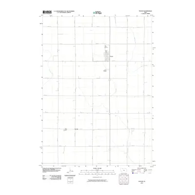
2010 Map of Fenton
USGS Topo · Published 2010About this map
The town of Fenton serves as the primary hub of this agricultural landscape in Kossuth County, established on a grid of section lines that define the local terrain. The community is anchored by the Fenton Post Office and nearby Saint Johns Cemetery, illustrating the long-standing settlement patterns of the Iowa prairie. To the southwest, the small settlement of Fairville sits near the Saint Lukes Cemetery, marking another historic point of interest for researchers tracing the development of rural townships. The drainage of the land is defined by the winding paths of Black Cat Creek and Lotts Creek, which break the rigid geometry of the gravel road network. These waterways and the presence of the United Methodist Cemetery provide a clear view of the region's geography at the start of the 21st century, where the landscape remains dominated by expansive farmland and small, persistent rural centers.
Find a feature on this map
23 named features on this map. Tap any name to fly to it.
Don’t see what you’re looking for? This feature index may not catch every label — zoom into the map to look around manually.
Map Details
Editions of this 2010 Fenton Map
This is the sole edition of this map. No revisions or reprints were ever made.
Other maps of this area

1954 · Fairmont
USGS Topo · 1:250,000

1958 · Fairmont
USGS Topo · 1:250,000

1980 · Lone Rock
USGS Topo · 1:24,000

1980 · Fenton
USGS Topo · 1:24,000

1980 · Depew
USGS Topo · 1:24,000

1980 · Seneca
USGS Topo · 1:24,000

1980 · Ringsted
USGS Topo · 1:24,000

1980 · Armstrong SE
USGS Topo · 1:24,000

1980 · Hobarton
USGS Topo · 1:24,000
1980 · Whittemore
USGS Topo · 1:24,000