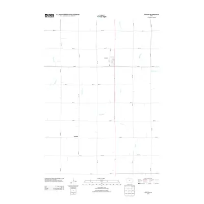
2013 Map of Fenton
USGS Topo · Published 2013About this map
Fenton serves as the primary municipal center in this section of northern Iowa, characterized by a structured grid of streets including Oak St, Elm St, and Ash St. The surrounding agricultural landscape is defined by an extensive network of range and township roads, with the small settlement of Fairville located to the southwest. This 2013 survey illustrates the highly managed hydrology of the region, where natural drainage systems like Lotts Cr and Black Cat Cr are supplemented by man-made improvements such as Ditch Number 1. The map reveals a transition between the meandering paths of Cylinder Cr and the rigid section-line road system, reflecting a century of land division and drainage efforts designed to maximize the productivity of the Kossuth County prairie.
Find a feature on this map
31 named features on this map. Tap any name to fly to it.
Don’t see what you’re looking for? This feature index may not catch every label — zoom into the map to look around manually.
Map Details
Editions of this 2013 Fenton Map
This is the sole edition of this map. No revisions or reprints were ever made.
Other maps of this area

1954 · Fairmont
USGS Topo · 1:250,000

1958 · Fairmont
USGS Topo · 1:250,000

1980 · Lone Rock
USGS Topo · 1:24,000

1980 · Fenton
USGS Topo · 1:24,000

1980 · Depew
USGS Topo · 1:24,000

1980 · Seneca
USGS Topo · 1:24,000

1980 · Ringsted
USGS Topo · 1:24,000

1980 · Armstrong SE
USGS Topo · 1:24,000

1980 · Hobarton
USGS Topo · 1:24,000
1980 · Whittemore
USGS Topo · 1:24,000