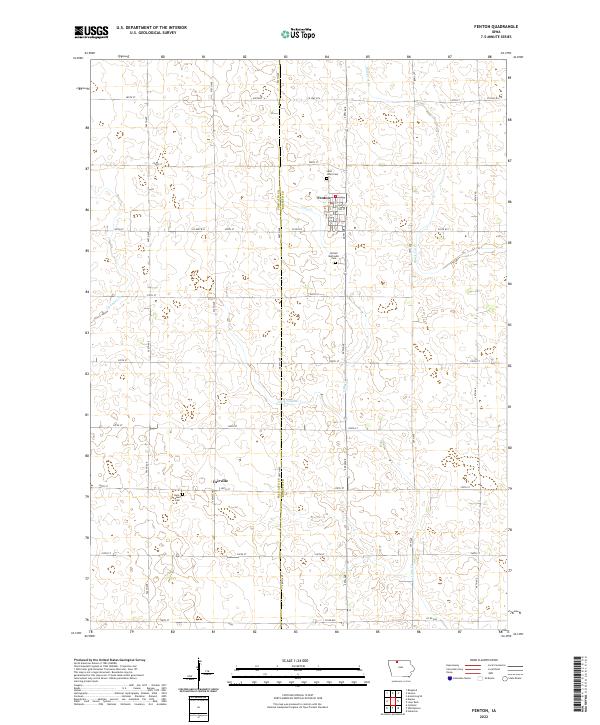
2022 Map of Fenton
USGS Topo · Published 2022About this map
Fenton and Fairville anchor this agricultural landscape on the border of Palo Alto and Kossuth counties. The terrain is defined by a dense grid of section roads and the natural meandering of Black Cat Creek and Lotts Creek, illustrating the classic Midwestern township system. For genealogists and local historians, several landmarks offer points of reference, including Saint Johns Cemetery north of Fenton and the United Methodist Cemetery to the south. Further south near Fairville, Saint Lukes Cemetery provides additional historical documentation for family researchers. The map also traces the drainage patterns of the region, including Cylinder Creek and the engineered water management of Ditch Number 1, which reflect the area's long-standing adaptation for large-scale cultivation.
Find a feature on this map
32 named features on this map. Tap any name to fly to it.
Don’t see what you’re looking for? This feature index may not catch every label — zoom into the map to look around manually.
Map Details
Editions of this 2022 Fenton Map
This is the sole edition of this map. No revisions or reprints were ever made.
Other maps of this area

1954 · Fairmont
USGS Topo · 1:250,000

1958 · Fairmont
USGS Topo · 1:250,000

1980 · Lone Rock
USGS Topo · 1:24,000

1980 · Fenton
USGS Topo · 1:24,000

1980 · Depew
USGS Topo · 1:24,000

1980 · Seneca
USGS Topo · 1:24,000

1980 · Ringsted
USGS Topo · 1:24,000

1980 · Armstrong SE
USGS Topo · 1:24,000

1980 · Hobarton
USGS Topo · 1:24,000
1980 · Whittemore
USGS Topo · 1:24,000