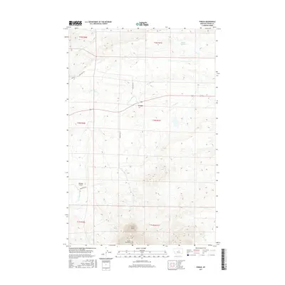
2017 Map of Fergus
USGS Topo · Published 2017About this map
The Fergus settlement serves as the central point for this high-plains landscape, where the northern reaches of the Judith Mountains dominate the southern topography. Significant elevation changes are marked by Cone Butte and the steep walls of Mitchell Canyon, providing a stark contrast to the drainage patterns of Box Elder Cr and its tributaries that cut across the central ranch lands.
Find a feature on this map
20 named features on this map. Tap any name to fly to it.
Don’t see what you’re looking for? This feature index may not catch every label — zoom into the map to look around manually.
Map Details
Editions of this 2017 Fergus Map
This is the sole edition of this map. No revisions or reprints were ever made.
Other maps of this area

1941 · Judith Peak
USGS Topo · 1:62,500

1944 · Judith Peak
USGS Topo · 1:62,500

1954 · Lewistown
USGS Topo · 1:250,000

1959 · Lewistown
USGS Topo · 1:250,000

1978 · Lewistown
USGS Topo · 1:100,000

1985 · The Horse Ranch
USGS Topo · 1:24,000

1985 · Fergus
USGS Topo · 1:24,000

1985 · Roy
USGS Topo · 1:24,000

1985 · Armells
USGS Topo · 1:24,000
1985 · Roy NW
USGS Topo · 1:24,000