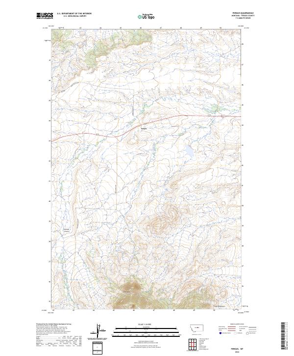
2024 Map of Fergus
USGS Topo · Published 2024About this map
Fergus serves as a central point of reference in this landscape defined by the northern reaches of the Judith Mountains. The terrain transitions from the elevated heights of Cone Butte in the south to the drainage basins of several prominent local waterways, including Box Elder Creek and Brush Creek. This modern survey illustrates the current drainage patterns and rural infrastructure of Fergus County, showing a network of secondary roads such as Horse Ranch Rd and Romundstad Rd that connect isolated ranching and mountain access points. The detailed elevation contours reveal the transition from the valley floor along Dry Armells Creek to the sharp rises of Mitchell Canyon, providing an essential reference for understanding the geographic relationship between these mountain features and the surrounding plains.
Find a feature on this map
20 named features on this map. Tap any name to fly to it.
Don’t see what you’re looking for? This feature index may not catch every label — zoom into the map to look around manually.
Map Details
Editions of this 2024 Fergus Map
This is the sole edition of this map. No revisions or reprints were ever made.
Other maps of this area

1941 · Judith Peak
USGS Topo · 1:62,500

1944 · Judith Peak
USGS Topo · 1:62,500

1954 · Lewistown
USGS Topo · 1:250,000

1959 · Lewistown
USGS Topo · 1:250,000

1978 · Lewistown
USGS Topo · 1:100,000

1985 · The Horse Ranch
USGS Topo · 1:24,000

1985 · Fergus
USGS Topo · 1:24,000

1985 · Roy
USGS Topo · 1:24,000

1985 · Armells
USGS Topo · 1:24,000
1985 · Roy NW
USGS Topo · 1:24,000