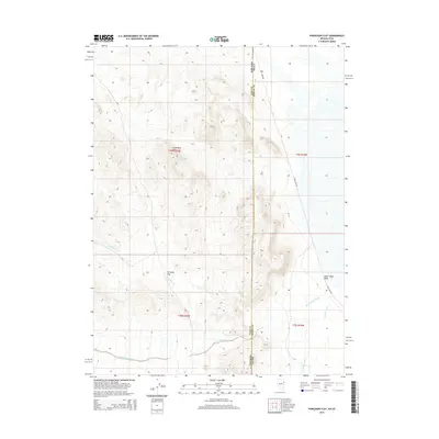
2014 Map of Ferguson Flat
USGS Topo · Published 2014About this map
Lead Mine Hills dominate the western portion of this Great Basin landscape, situated along the state line where Elko County, Nevada, meets Tooele County, Utah. This high-desert terrain is defined by a series of intermittent drainage systems, including Ferguson Cr and Dead Cedar Wash, which flow eastward from the slopes toward the salt flats. The presence of Ferguson Flat at the base of these hills suggests a historic natural catchment or grazing area, while the name Lead Mine Hills hints at the mineral prospecting history common to this remote border region. Modern transit is represented primarily by Blue Lakes Rd, which traverses the flatter eastern expanses of the quadrangle, paralleling the north-south state boundary.
Find a feature on this map
12 named features on this map. Tap any name to fly to it.
Don’t see what you’re looking for? This feature index may not catch every label — zoom into the map to look around manually.
Map Details
Editions of this 2014 Ferguson Flat Map
This is the sole edition of this map. No revisions or reprints were ever made.
Other maps of this area

1953 · Tooele
USGS Topo · 1:250,000

1955 · Tooele
USGS Topo · 1:250,000

1955 · Elko
USGS Topo · 1:250,000

1958 · Elko
USGS Topo · 1:250,000

1962 · Elko
USGS Topo · 1:250,000

1965 · Elko
USGS Topo · 1:250,000

1972 · Ferguson Flat
USGS Topo · 1:24,000

1972 · White Horse Pass
USGS Topo · 1:24,000

1972 · Utah Peak
USGS Topo · 1:24,000

1972 · Ferguson Mtn.
USGS Topo · 1:24,000