
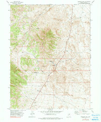
1972 Map of Ferguson Mtn.
USGS Topo · Published 1975About this map
The high desert landscape of eastern Elko County is defined here by the convergence of the Goshute Mountains and Ferguson Mtn. This early 1970s survey captures a sparse network of ranching and utility infrastructure centered around vital water sources. The Ferguson Sprs Maint Sta serves as a lone human outpost along the main road, supported by the nearby Ferguson Springs and a designated Picnic Area. The presence of Felt Corral and Dead Cedar Corral suggests the continued use of this arid range for livestock, while numerous Prospects, Borrow Pits, and the Dead Cedar Mine indicate the area's mineral exploration history. A web of Jeep Trails and unnamed Trails crisscrosses the terrain, following natural features like Dead Cedar Wash and providing access to remote locations like Little Mud Spring and Felt Spring.
Find a feature on this map
18 named features on this map. Tap any name to fly to it.
Don’t see what you’re looking for? This feature index may not catch every label — zoom into the map to look around manually.
Map Details
Editions of this 1972 Ferguson Mtn. Map
2 editions found
Other maps of this area

1955 · Elko
USGS Topo · 1:250,000

1958 · Elko
USGS Topo · 1:250,000

1962 · Elko
USGS Topo · 1:250,000

1965 · Elko
USGS Topo · 1:250,000

1972 · Ferguson Flat
USGS Topo · 1:24,000

1972 · Lion Spring
USGS Topo · 1:24,000

1972 · White Horse Pass
USGS Topo · 1:24,000

1972 · Utah Peak
USGS Topo · 1:24,000
1972 · Spring Gulch
USGS Topo · 1:24,000
1972 · Wendover SE
USGS Topo · 1:24,000