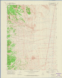
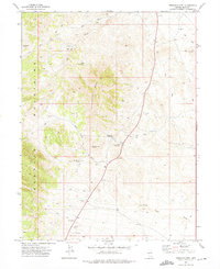
1972 Map of Spring Gulch
USGS Topo · Published 1975About this map
The high ridgelines of the Goshute Mountains dominate this 1970s survey, rising sharply above the desert floor of eastern Elko County. The terrain is defined by dramatic geological features such as Wildcat Peak and the hidden formation of Natural Arch, which sits tucked into the steep slopes above Spring Gulch. Drainage patterns like Lion Canyon and Felt Wash cut through the arid landscape, while the presence of a lone Corral and scattered Prospect markers suggest a history of intermittent ranching and mineral exploration in this secluded corner of Nevada.
Find a feature on this map
16 named features on this map. Tap any name to fly to it.
Don’t see what you’re looking for? This feature index may not catch every label — zoom into the map to look around manually.
Map Details
Editions of this 1972 Spring Gulch Map
This is the sole edition of this map. No revisions or reprints were ever made.
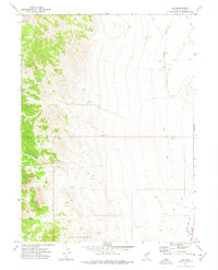
Other maps of this area

1955 · Elko
USGS Topo · 1:250,000

1958 · Elko
USGS Topo · 1:250,000

1962 · Elko
USGS Topo · 1:250,000

1965 · Elko
USGS Topo · 1:250,000
1972 · Ferguson Flat
USGS Topo · 1:24,000
1972 · Morgan Pass
USGS Topo · 1:24,000
1972 · Lion Spring
USGS Topo · 1:24,000
1972 · Ferguson Mtn.
USGS Topo · 1:24,000
1972 · Ola
USGS Topo · 1:24,000
1972 · Wendover
USGS Topo · 1:24,000