
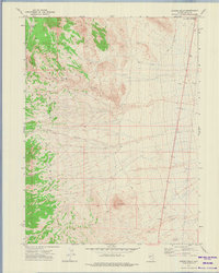
1972 Map of Ola
USGS Topo · Published 1975About this map
The Goshute Mountains dominate the western edge of this Nevada landscape, where steep slopes descend into the arid expanse of the Great Basin. This 1972 survey records a region defined by its isolation and the critical importance of water sources, featuring Morris Basin Spring, Mud Spring, and the Wendover Well. The small settlement of Ola sits along the Pacific Western Jeep Trail, representing the sparse human footprint in Elko County during the early 1970s.
Find a feature on this map
16 named features on this map. Tap any name to fly to it.
Don’t see what you’re looking for? This feature index may not catch every label — zoom into the map to look around manually.
Map Details
Editions of this 1972 Ola Map
This is the sole edition of this map. No revisions or reprints were ever made.
Other maps of this area

1955 · Elko
USGS Topo · 1:250,000

1958 · Elko
USGS Topo · 1:250,000

1962 · Elko
USGS Topo · 1:250,000

1965 · Elko
USGS Topo · 1:250,000

1971 · West Morris Basin
USGS Topo · 1:24,000

1971 · Pilot
USGS Topo · 1:24,000

1971 · Leppy Peak
USGS Topo · 1:24,000

1972 · Morgan Pass
USGS Topo · 1:24,000

1972 · Lion Spring
USGS Topo · 1:24,000
1972 · Spring Gulch
USGS Topo · 1:24,000