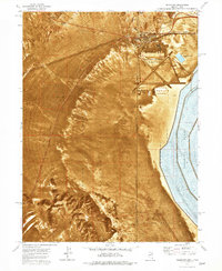
1972 Map of Wendover
USGS Topo · Published 1977About this map
Wendover straddles the state line in the early 1970s, serving as a hub for military operations, transportation, and recreation. The landscape is dominated by the Wendover Air Force Auxiliary Field and the adjacent Wendover Air Force Range, which occupy the vast Alkali or Mud flats. These military installations are contrasted by the natural features of the Leppy Hills and Sand Dunes to the north and east.
Find a feature on this map
30 named features on this map. Tap any name to fly to it.
Don’t see what you’re looking for? This feature index may not catch every label — zoom into the map to look around manually.
Map Details
Editions of this 1972 Wendover Map
This is the sole edition of this map. No revisions or reprints were ever made.
Other maps of this area

1953 · Tooele
USGS Topo · 1:250,000

1955 · Tooele
USGS Topo · 1:250,000

1955 · Elko
USGS Topo · 1:250,000

1958 · Elko
USGS Topo · 1:250,000

1962 · Elko
USGS Topo · 1:250,000

1965 · Elko
USGS Topo · 1:250,000

1971 · Pilot
USGS Topo · 1:24,000

1971 · Leppy Peak
USGS Topo · 1:24,000

1971 · Tetzlaff Peak
USGS Topo · 1:24,000

1972 · Ola
USGS Topo · 1:24,000