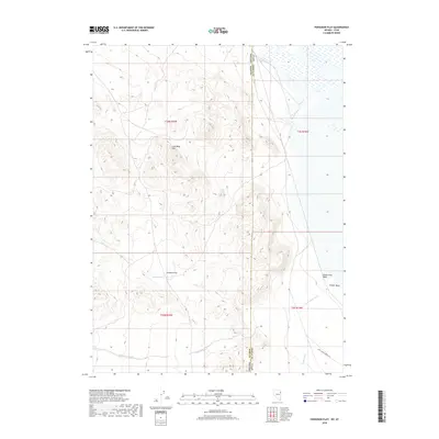
2018 Map of Ferguson Flat
USGS Topo · Published 2018About this map
Lead Mine Hills rise above the high desert floor on the border of Utah and Nevada, defining the western edge of Tooele County. This arid landscape is marked by the broad expanse of Ferguson Flat and a network of ephemeral drainage systems including Dead Cedar Wash, Ferber Wash, and Ferguson Cr. The topography here illustrates the classic basin and range character of the region, where isolated mountain blocks are separated by broad, sediment-filled valleys. Significant for those tracking land use and historic routes, the map shows Last Chance North Rd skirting the southeastern corner of the quadrangle. The survey also delineates the precise township and range divisions, such as t30n r70e and t4s r19w, which are essential for locating specific historical land claims and grazing allotments along the state line.
Find a feature on this map
12 named features on this map. Tap any name to fly to it.
Don’t see what you’re looking for? This feature index may not catch every label — zoom into the map to look around manually.
Map Details
Editions of this 2018 Ferguson Flat Map
This is the sole edition of this map. No revisions or reprints were ever made.
Other maps of this area

1953 · Tooele
USGS Topo · 1:250,000

1955 · Tooele
USGS Topo · 1:250,000

1955 · Elko
USGS Topo · 1:250,000

1958 · Elko
USGS Topo · 1:250,000

1962 · Elko
USGS Topo · 1:250,000

1965 · Elko
USGS Topo · 1:250,000

1972 · Ferguson Flat
USGS Topo · 1:24,000

1972 · White Horse Pass
USGS Topo · 1:24,000

1972 · Utah Peak
USGS Topo · 1:24,000

1972 · Ferguson Mtn.
USGS Topo · 1:24,000