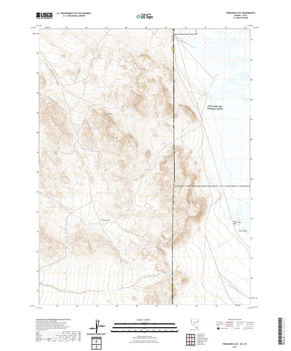
2021 Map of Ferguson Flat
USGS Topo · Published 2021About this map
Lead Mine Hills rise above the high desert floor along the border of Nevada and Utah, anchoring a landscape defined by seasonal drainages and wide alluvial basins. This modern topographic survey highlights the stark geography of the eastern edge of Elko County, where Ferguson Flat provides a level expanse between the rising peaks and the state line. The drainage network is characterized by intermittent flows such as Ferguson Cr, while the eastern portion of the quadrangle transitions into the broad, sandy reaches of Dead Cedar Wash and Ferber Wash. These features trace the natural path of water through an arid environment, illustrating the geographic constraints that have long influenced movement and land use in this borderland region.
Find a feature on this map
9 named features on this map. Tap any name to fly to it.
Don’t see what you’re looking for? This feature index may not catch every label — zoom into the map to look around manually.
Map Details
Editions of this 2021 Ferguson Flat Map
This is the sole edition of this map. No revisions or reprints were ever made.
Other maps of this area

1953 · Tooele
USGS Topo · 1:250,000

1955 · Tooele
USGS Topo · 1:250,000

1955 · Elko
USGS Topo · 1:250,000

1958 · Elko
USGS Topo · 1:250,000

1962 · Elko
USGS Topo · 1:250,000

1965 · Elko
USGS Topo · 1:250,000

1972 · Ferguson Flat
USGS Topo · 1:24,000

1972 · White Horse Pass
USGS Topo · 1:24,000

1972 · Utah Peak
USGS Topo · 1:24,000

1972 · Ferguson Mtn.
USGS Topo · 1:24,000