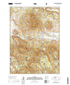
2020 Map of Ferguson Mountain
USGS Topo · Published 2020About this map
Sprague River meanders through the heart of this Klamath County landscape, defining the agricultural character of the Sprague River Valley near Beatty Gap. The terrain is marked by significant volcanic rises, including Ferguson Mtn and Medicine Mtn, while the southern half of the map is dominated by the Fremont National Forest. Evidence of early land management and water rights appears in the network of canals like Elder Ditch and several named catchments such as Witch Drain Pond and Rum Pond. For those researching local heritage, the Masekesket Cem is a notable landmark situated just north of the river. The presence of Railroad Dr and various timber-access routes like Medicine Mtn Dr suggests a landscape shaped by both ranching and the forest products industry. Distinctive place names like Whiskey John Flat on the eastern edge add a unique local character to this high-country survey.
Find a feature on this map
55 named features on this map. Tap any name to fly to it.
Don’t see what you’re looking for? This feature index may not catch every label — zoom into the map to look around manually.
Map Details
Editions of this 2020 Ferguson Mountain Map
This is the sole edition of this map. No revisions or reprints were ever made.
Other maps of this area

1889 · Klamath
USGS Topo · 1:250,000

1894 · Klamath
USGS Topo · 1:250,000

1955 · Klamath Falls
USGS Topo · 1:250,000

1958 · Klamath Falls
USGS Topo · 1:250,000

1960 · Riverbed Butte
USGS Topo · 1:62,500

1960 · Bly
USGS Topo · 1:62,500

1960 · Beatty
USGS Topo · 1:62,500

1960 · Fuego Mountain
USGS Topo · 1:62,500

1980 · Williamson River
USGS Topo · 1:100,000
1988 · Yainax Butte
USGS Topo · 1:24,000