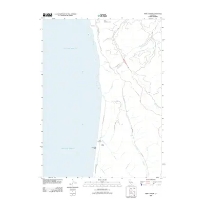
2012 Map of Fern Canyon
USGS Topo · Published 2012About this map
Gold Bluffs Beach and the iconic Fern Canyon anchor this coastal portrait of the Humboldt County shoreline. The landscape is defined by the steep transition from the Pacific Ocean to the timbered ridges of the Prairie Creek Redwoods SP. The Redwood Hwy follows the course of Prairie Cr, serving as the primary corridor through this densely forested region. To the north, the Alder Forestry Conservation Camp stands near the headwaters of Waukell Cr, while landmarks like Split Rock and Gold Bluffs provide unmistakable coastal markers. Numerous drainages, including Johnson Cr and McGarvey Cr, cut through the terrain, illustrating the intricate watershed that supports the ancient redwood groves. The map traces secondary routes such as Alder Camp Rd and Ah Pah Rd, which penetrate the interior forests east of the coastline.
Find a feature on this map
25 named features on this map. Tap any name to fly to it.
Don’t see what you’re looking for? This feature index may not catch every label — zoom into the map to look around manually.
Map Details
Editions of this 2012 Fern Canyon Map
This is the sole edition of this map. No revisions or reprints were ever made.
Other maps of this area

1922 · Preston Peak
USGS Topo · 1:125,000

1925 · Hoopa
USGS Topo · 1:125,000

1929 · Crescent City
USGS Topo · 1:125,000

1945 · Ship Mountain
USGS Topo · 1:62,500

1945 · Orick
USGS Topo · 1:62,500

1945 · Requa
USGS Topo · 1:62,500

1945 · Tectah Creek
USGS Topo · 1:62,500

1948 · Weed
USGS Topo · 1:250,000

1949 · Eureka
USGS Topo · 1:250,000

1950 · Weed
USGS Topo · 1:250,000