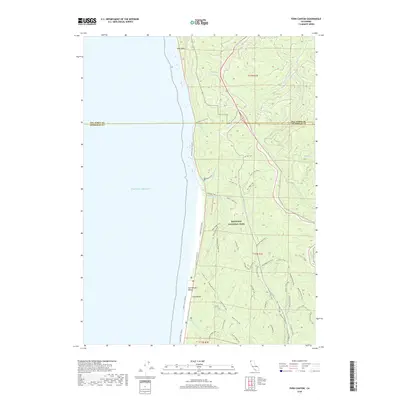
2018 Map of Fern Canyon
USGS Topo · Published 2018About this map
Redwood National Park dominates this coastal stretch of northern California, where the steep topography of the Pacific coast meets a dense network of hiking and pack trails. The landscape is defined by the proximity of the Pacific Ocean to the high ridges of the Coast Range, creating short, steep drainage basins for waterways like McGarvey Cr and Waukell Cr. At the shoreline, the notable Gold Bluffs Beach sits below the small settlement of Gold Bluffs, a name recalling the region's mineral history.
Find a feature on this map
45 named features on this map. Tap any name to fly to it.
Don’t see what you’re looking for? This feature index may not catch every label — zoom into the map to look around manually.
Map Details
Editions of this 2018 Fern Canyon Map
This is the sole edition of this map. No revisions or reprints were ever made.
Other maps of this area

1922 · Preston Peak
USGS Topo · 1:125,000

1925 · Hoopa
USGS Topo · 1:125,000

1929 · Crescent City
USGS Topo · 1:125,000

1945 · Ship Mountain
USGS Topo · 1:62,500

1945 · Orick
USGS Topo · 1:62,500

1945 · Requa
USGS Topo · 1:62,500

1945 · Tectah Creek
USGS Topo · 1:62,500

1948 · Weed
USGS Topo · 1:250,000

1949 · Eureka
USGS Topo · 1:250,000

1950 · Weed
USGS Topo · 1:250,000