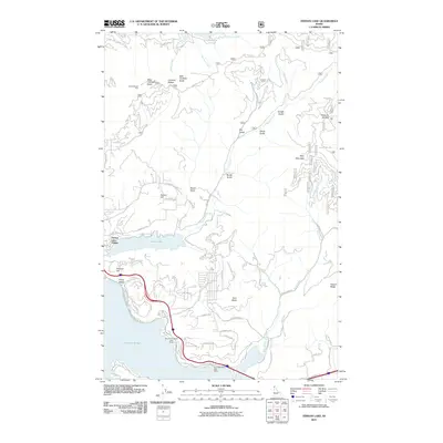
2011 Map of Fernan Lake
USGS Topo · Published 2011About this map
Fernan Lake Village and the shoreline of Fernan Lake define the western landscape of this Idaho study. The terrain rises sharply from the water toward the north and east, marked by Canfield Buttes and Kelly Mountain. The presence of Harrison Slough and the Silver Beach area suggests a community deeply tied to its waterfront, with public access facilitated by the Boothe Park Public Boat Ramp and Blue Point Public Boat Ramp.
Find a feature on this map
72 named features on this map. Tap any name to fly to it.
Don’t see what you’re looking for? This feature index may not catch every label — zoom into the map to look around manually.
Map Details
Editions of this 2011 Fernan Lake Map
This is the sole edition of this map. No revisions or reprints were ever made.
Other maps of this area

1903 · Rathdrum
USGS Topo · 1:125,000

1955 · Spokane
USGS Topo · 1:250,000

1957 · Coeur D'Alene
USGS Topo · 1:62,500

1957 · Lane
USGS Topo · 1:62,500

1958 · Spokane
USGS Topo · 1:250,000

1961 · Hayden
USGS Topo · 1:24,000

1961 · Spirit Lake
USGS Topo · 1:62,500

1961 · Athol
USGS Topo · 1:62,500

1961 · Hayden Lake
USGS Topo · 1:24,000

1975 · Coeur D'Alene SE
USGS Topo · 1:24,000