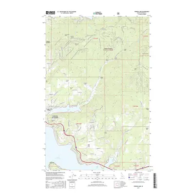
2017 Map of Fernan Lake
USGS Topo · Published 2017About this map
Coeur d'Alene and its eastern suburbs are documented here at a time of significant recreational and residential expansion. The map details the intricate transition from the urban grid into the Coeur d'Alene National Forest, where a dense network of trails like the Canfield Mtn Tr Cmplex Trail-D and Dry State OHV crisscross the high ridges of the Canfield Buttes. To the south, the shoreline of Coeur d'Alene Lake is articulated by distinct landings and bays, including Silver Beach, Bennett Bay, and Blue Creek Bay.
Find a feature on this map
124 named features on this map. Tap any name to fly to it.
Don’t see what you’re looking for? This feature index may not catch every label — zoom into the map to look around manually.
Map Details
Editions of this 2017 Fernan Lake Map
This is the sole edition of this map. No revisions or reprints were ever made.
Other maps of this area

1903 · Rathdrum
USGS Topo · 1:125,000

1955 · Spokane
USGS Topo · 1:250,000

1957 · Coeur D'Alene
USGS Topo · 1:62,500

1957 · Lane
USGS Topo · 1:62,500

1958 · Spokane
USGS Topo · 1:250,000

1961 · Hayden
USGS Topo · 1:24,000

1961 · Spirit Lake
USGS Topo · 1:62,500

1961 · Athol
USGS Topo · 1:62,500

1961 · Hayden Lake
USGS Topo · 1:24,000

1975 · Coeur D'Alene SE
USGS Topo · 1:24,000