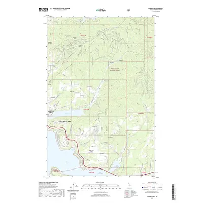
2020 Map of Fernan Lake
USGS Topo · Published 2020About this map
Coeur d'Alene serves as the focal point of this survey, where urban development meets the expansive waters of Coeur d'Alene Lake and the recreational gateway of Fernan Lake. The landscape is defined by the sharp transition from the residential grids of Dalton Gardens and Fernan Lake Village to the steep, wooded terrain of the Coeur d'Alene National Forest. Historical transit routes are evident in the path of the Captain John Mullan Rd, while the rugged eastern heights are marked by Potlatch Hill and Folsom Ridge.
Find a feature on this map
158 named features on this map. Tap any name to fly to it.
Don’t see what you’re looking for? This feature index may not catch every label — zoom into the map to look around manually.
Map Details
Editions of this 2020 Fernan Lake Map
This is the sole edition of this map. No revisions or reprints were ever made.
Other maps of this area

1903 · Rathdrum
USGS Topo · 1:125,000

1955 · Spokane
USGS Topo · 1:250,000

1957 · Coeur D'Alene
USGS Topo · 1:62,500

1957 · Lane
USGS Topo · 1:62,500

1958 · Spokane
USGS Topo · 1:250,000

1961 · Hayden
USGS Topo · 1:24,000

1961 · Spirit Lake
USGS Topo · 1:62,500

1961 · Athol
USGS Topo · 1:62,500

1961 · Hayden Lake
USGS Topo · 1:24,000

1975 · Coeur D'Alene SE
USGS Topo · 1:24,000