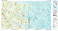
1981 Map of Fernandina Beach
USGS Topo · Published 1982About this map
Cumberland Island and its extensive National Seashore dominate this coastal survey, where the intricate waterways of the St Marys River and Nassau River define the Georgia-Florida border. The map illustrates a complex maritime environment at the start of the 1980s, highlighting the strategic and recreational importance of the region from the Kings Bay Naval Base to the protected grounds of Fort Clinch State Park. Inland, the rail-oriented growth of Folkston and Hilliard contrasts with the tidal marshes and coastal settlements like Franklintown and American Beach. Numerous landings and historic points such as Dungeness Wharf and Cumberland Wharf suggest a long history of water-based commerce and travel. The transition from timber and rail hub to a modern coastal economy is evident in the presence of Jacksonville International Airport and the sprawl of Fernandina Beach.
Find a feature on this map
131 named features on this map. Tap any name to fly to it.
Don’t see what you’re looking for? This feature index may not catch every label — zoom into the map to look around manually.
Map Details
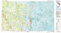
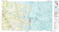
Editions of this 1981 Fernandina Beach Map
3 editions found
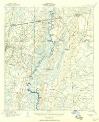
Other maps of this area
1917 · Nahunta
USGS Topo · 1:62,500

1917 · Cambon
USGS Topo · 1:62,500

1917 · Boulogne
USGS Topo · 1:62,500

1917 · Macclenny
USGS Topo · 1:62,500

1917 · Hilliard
USGS Topo · 1:62,500

1918 · St Marys
USGS Topo · 1:62,500

1918 · Cumberland Island
USGS Topo · 1:62,500

1918 · Folkston
USGS Topo · 1:62,500

1918 · Moniac
USGS Topo · 1:62,500
1918 · Nahunta
USGS Topo · 1:62,500