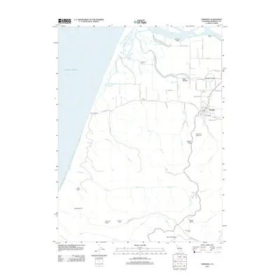
2012 Map of Ferndale
USGS Topo · Published 2012About this map
Ferndale sits at the base of Wildcat Ridge in the early 21st century, serving as the cultural hub for a landscape defined by the complex hydrology of the Eel River Delta. The coastal plains to the west are characterized by numerous sloughs and creeks, including Centerville Slough and Cutoff Slough, which drain toward the Pacific Ocean at Centerville Beach. The map highlights a series of established landholdings and small settlements that reflect the area's agricultural roots, such as Fern Cottage, Occidental Ranch, and Bunker Hill Ranch.
Find a feature on this map
63 named features on this map. Tap any name to fly to it.
Don’t see what you’re looking for? This feature index may not catch every label — zoom into the map to look around manually.
Map Details
Editions of this 2012 Ferndale Map
This is the sole edition of this map. No revisions or reprints were ever made.
Other maps of this area

1916 · Cape Fortunas
USGS Topo · 1:62,500

1919 · Glynn
USGS Topo · 1:62,500

1921 · Cape Mendocino
USGS Topo · 1:62,500

1943 · Ferndale
USGS Topo · 1:62,500

1944 · Fortuna
USGS Topo · 1:62,500

1949 · Eureka
USGS Topo · 1:250,000

1950 · Cape Mendocino
USGS Topo · 1:62,500

1950 · Scotia
USGS Topo · 1:62,500

1951 · Scotia
USGS Topo · 1:62,500

1951 · Cape Mendocino
USGS Topo · 1:62,500