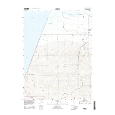
2015 Map of Ferndale
USGS Topo · Published 2015About this map
Ferndale sits at the base of a sharp transition between the alluvial plains of the Eel River and the steep, complex relief of the Wildcat Ridge. This survey details a landscape defined by water management and topography, where the Salt River and various sloughs like Centerville Slough and Cutoff Slough thread through the lowlands north of town. The transition from the grid-aligned dairy lands near Arlynda Corners and Port Kenyon to the winding mountain roads of the south is immediate. Genealogists will find interest in the proximity of Ferndale Cemetery and Saint Marys Cemetery on the edge of the settlement. Further south, the map climbs into the hills of Oil Creek Ridge and Bear River Ridge, showing the dramatic elevation changes that isolate small inland pockets like Sleepy Hollow. The coastal boundary is marked by the Pacific Ocean and the mouth of the river system near Cock Robin Island.
Find a feature on this map
56 named features on this map. Tap any name to fly to it.
Don’t see what you’re looking for? This feature index may not catch every label — zoom into the map to look around manually.
Map Details
Editions of this 2015 Ferndale Map
This is the sole edition of this map. No revisions or reprints were ever made.
Other maps of this area

1916 · Cape Fortunas
USGS Topo · 1:62,500

1919 · Glynn
USGS Topo · 1:62,500

1921 · Cape Mendocino
USGS Topo · 1:62,500

1943 · Ferndale
USGS Topo · 1:62,500

1944 · Fortuna
USGS Topo · 1:62,500

1949 · Eureka
USGS Topo · 1:250,000

1950 · Cape Mendocino
USGS Topo · 1:62,500

1950 · Scotia
USGS Topo · 1:62,500

1951 · Scotia
USGS Topo · 1:62,500

1951 · Cape Mendocino
USGS Topo · 1:62,500