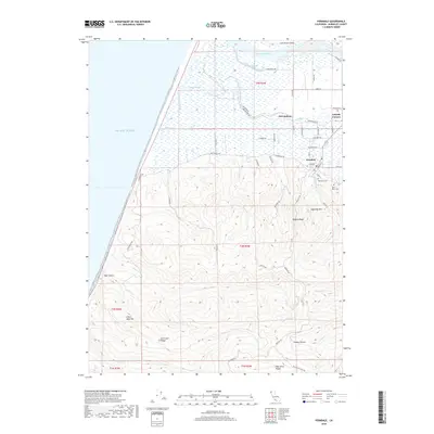
2018 Map of Ferndale
USGS Topo · Published 2018About this map
The Victorian-era architecture of Ferndale transitions into the fertile dairy lands and coastal sloughs at the mouth of the Eel River. This topographic landscape illustrates the relationship between the town and its historic outlets, including Port Kenyon and Arlynda Corners. The northern half of the map is dominated by the complex hydrology of Centerville Slough and Salt River, while the southern portion rises sharply into the uplands of Wildcat Ridge and Sugarloaf Mtn. Local genealogists can locate the Ferndale Cem and Saint Marys Cem on the eastern slopes, while researchers of the coastal frontier can trace the winding route of Mattole Rd as it begins its journey south toward the remote Bear River Ridge. The survey details the intricate grid of rural lanes like Guthrie Cr and Price Cr that have long defined this Humboldt County agricultural hub.
Find a feature on this map
63 named features on this map. Tap any name to fly to it.
Don’t see what you’re looking for? This feature index may not catch every label — zoom into the map to look around manually.
Map Details
Editions of this 2018 Ferndale Map
This is the sole edition of this map. No revisions or reprints were ever made.
Other maps of this area

1916 · Cape Fortunas
USGS Topo · 1:62,500

1919 · Glynn
USGS Topo · 1:62,500

1921 · Cape Mendocino
USGS Topo · 1:62,500

1943 · Ferndale
USGS Topo · 1:62,500

1944 · Fortuna
USGS Topo · 1:62,500

1949 · Eureka
USGS Topo · 1:250,000

1950 · Cape Mendocino
USGS Topo · 1:62,500

1950 · Scotia
USGS Topo · 1:62,500

1951 · Scotia
USGS Topo · 1:62,500

1951 · Cape Mendocino
USGS Topo · 1:62,500