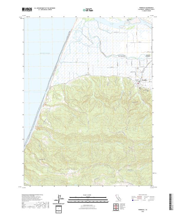
2022 Map of Ferndale
USGS Topo · Published 2022About this map
Ferndale sits at the foot of the hills where the coastal pastures meet the steep ascent of the coastal range. This coastal landscape is defined by the complex hydrology of the Eel River delta, including the Salt River, Cutoff Slough, and the marshy grounds of Cock Robin Island. The transition from the alluvial flats near Port Kenyon and Arlynda Corners to the sharp elevation of Sugarloaf Mtn and Wildcat Ridge illustrates the physical constraints that shaped early settlement patterns. Genealogy researchers will find the locations of Ferndale Cem and Saint Marys Cem clearly marked on the southern edge of town. To the west, the coastline is accessible via the Eel River to Centerville Beach Trl, while the interior is marked by significant landmarks like Bear River Ridge and Little Bald Hill.
Find a feature on this map
69 named features on this map. Tap any name to fly to it.
Don’t see what you’re looking for? This feature index may not catch every label — zoom into the map to look around manually.
Map Details
Editions of this 2022 Ferndale Map
This is the sole edition of this map. No revisions or reprints were ever made.
Other maps of this area

1916 · Cape Fortunas
USGS Topo · 1:62,500

1919 · Glynn
USGS Topo · 1:62,500

1921 · Cape Mendocino
USGS Topo · 1:62,500

1943 · Ferndale
USGS Topo · 1:62,500

1944 · Fortuna
USGS Topo · 1:62,500

1949 · Eureka
USGS Topo · 1:250,000

1950 · Cape Mendocino
USGS Topo · 1:62,500

1950 · Scotia
USGS Topo · 1:62,500

1951 · Scotia
USGS Topo · 1:62,500

1951 · Cape Mendocino
USGS Topo · 1:62,500