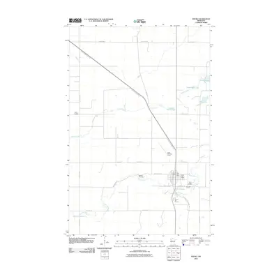
2010 Map of Fertile
USGS Topo · Published 2010About this map
The Sand Hill River meanders through this Polk County landscape, anchored by the settlement of Fertile. The town serves as a local hub, featuring the Fertile Post Office, a municipal airport, and the Fertile Golf Course along the riverbanks. For genealogists and local historians, the map is a significant record of the community's burial grounds, including Varnes Lutheran Cemetery to the west and a cluster of sites near the town center: Saint Josephs Cemetery, Concordia Cemetery, and Pleasant Hill Cemetery. The infrastructure reflects a blend of historic routes and modern utility, with the Pembina Trl and the Agassiz Recreational Trl cutting diagonally across the section lines. Water features like Little Andrew Lake and Cheese Brown Lake dot the northern reaches, while the Sand Hill River Dam controls the flow just west of the main settlement.
Find a feature on this map
29 named features on this map. Tap any name to fly to it.
Don’t see what you’re looking for? This feature index may not catch every label — zoom into the map to look around manually.
Map Details
Editions of this 2010 Fertile Map
This is the sole edition of this map. No revisions or reprints were ever made.
Other maps of this area

1918 · Twin Valley
USGS Topo · 1:62,500

1919 · Valley
USGS Topo · 1:62,500

1952 · Grand Forks
USGS Topo · 1:250,000

1956 · Grand Forks
USGS Topo · 1:250,000

1965 · Dugdale
USGS Topo · 1:24,000

1965 · Fertile
USGS Topo · 1:24,000

1965 · Melvin
USGS Topo · 1:24,000

1965 · Harold
USGS Topo · 1:24,000

1965 · Twin Valley NW
USGS Topo · 1:24,000

1965 · Flaming
USGS Topo · 1:24,000