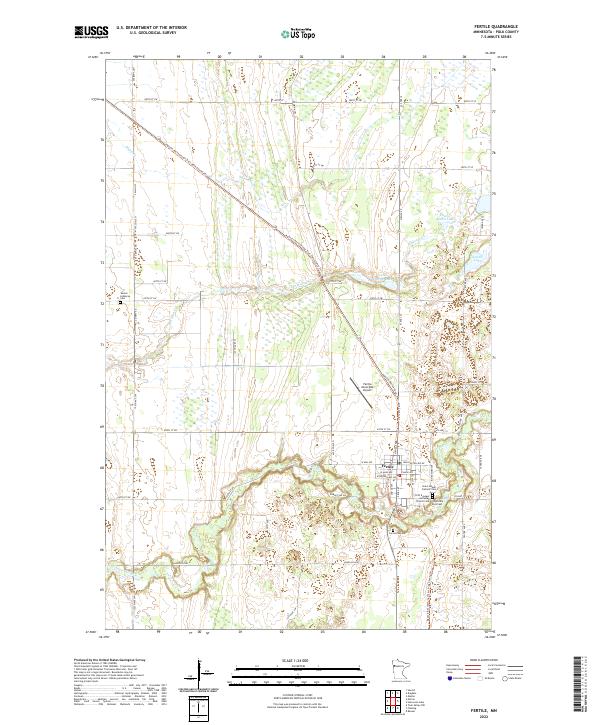
2022 Map of Fertile
USGS Topo · Published 2022About this map
Fertile occupies a key position at the bend of the Sand Hill River, serving as the primary hub for this portion of Polk County. The town's layout is anchored by a series of significant local heritage sites, including the Saint Joseph Catholic Cem and First Evangel Lutheran Church Cem located near the river's edge. To the north, the Fertile Municipal Airport and the sprawling Agassiz Recreational Trail-Polk County Trl follow the path of a former transportation corridor, cutting diagonally across the prairie landscape.
Find a feature on this map
42 named features on this map. Tap any name to fly to it.
Don’t see what you’re looking for? This feature index may not catch every label — zoom into the map to look around manually.
Map Details
Editions of this 2022 Fertile Map
This is the sole edition of this map. No revisions or reprints were ever made.
Other maps of this area

1918 · Twin Valley
USGS Topo · 1:62,500

1919 · Valley
USGS Topo · 1:62,500

1952 · Grand Forks
USGS Topo · 1:250,000

1956 · Grand Forks
USGS Topo · 1:250,000

1965 · Dugdale
USGS Topo · 1:24,000

1965 · Fertile
USGS Topo · 1:24,000

1965 · Melvin
USGS Topo · 1:24,000

1965 · Harold
USGS Topo · 1:24,000

1965 · Twin Valley NW
USGS Topo · 1:24,000

1965 · Flaming
USGS Topo · 1:24,000