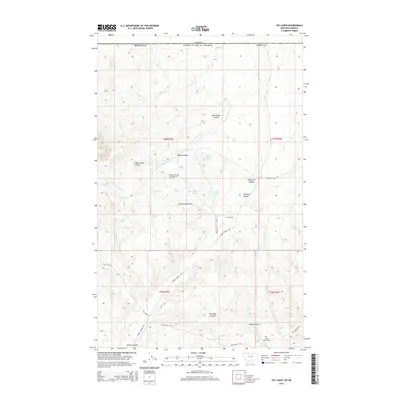
2014 Map of Fey Lakes
USGS Topo · Published 2014About this map
Sweet Grass Hills dominate this portion of Toole County, Montana, just south of the border between the Canada and the United States. The landscape is defined by its complex hydrology and dramatic relief, featuring numerous named depressions and drainage features such as The Deep Ground, Sam Ross Coulee, and Eclipse Gulch. The presence of the Fred and George Creek Oil and Gas Field indicates the region's industrial ties to energy extraction, while the Gold Butte Cem near the southern edge offers a point of interest for genealogists tracing local families in the area.
Find a feature on this map
38 named features on this map. Tap any name to fly to it.
Don’t see what you’re looking for? This feature index may not catch every label — zoom into the map to look around manually.
Map Details
Editions of this 2014 Fey Lakes Map
This is the sole edition of this map. No revisions or reprints were ever made.
Other maps of this area

1945 · West Butte
USGS Topo · 1:62,500

1954 · Shelby
USGS Topo · 1:250,000

1958 · Shelby
USGS Topo · 1:250,000

1962 · Whitlash
USGS Topo · 1:24,000

1962 · Cameron Lake
USGS Topo · 1:24,000

1962 · Fey Lakes
USGS Topo · 1:24,000

1962 · Grassy Butte
USGS Topo · 1:24,000

1984 · Sweet Grass Hills
USGS Topo · 1:100,000
1986 · West Butte
USGS Topo · 1:24,000
1986 · Fivemile Coulee East
USGS Topo · 1:24,000