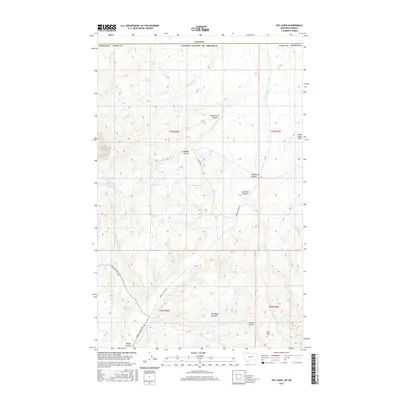
2017 Map of Fey Lakes
USGS Topo · Published 2017About this map
Gold Butte and its surrounding high plains define this landscape along the international border in Toole County. The terrain is marked by a series of glacial depressions and ephemeral waters, including the Fey Lakes, Ruby Johnson Lake, and Alkali Lake. In the northern reach, the map traces the boundary between the United States and Canada, where drainage patterns like Prichard Creek and Dead Horse Coulee flow through open range land. This area, known for its proximity to the Sweet Grass Hills, shows the legacy of early ranching and mining through its road network. Notable local history sites include the Gold Butte Cemetery, which rests near Eclipse Gulch and Miners Coulee. The presence of named features like The Pot Hole and The Deep Ground suggests a landscape shaped by distinct geological formations, characteristic of the northern Montana prairie.
Find a feature on this map
36 named features on this map. Tap any name to fly to it.
Don’t see what you’re looking for? This feature index may not catch every label — zoom into the map to look around manually.
Map Details
Editions of this 2017 Fey Lakes Map
This is the sole edition of this map. No revisions or reprints were ever made.
Other maps of this area

1945 · West Butte
USGS Topo · 1:62,500

1954 · Shelby
USGS Topo · 1:250,000

1958 · Shelby
USGS Topo · 1:250,000

1962 · Whitlash
USGS Topo · 1:24,000

1962 · Cameron Lake
USGS Topo · 1:24,000

1962 · Fey Lakes
USGS Topo · 1:24,000

1962 · Grassy Butte
USGS Topo · 1:24,000

1984 · Sweet Grass Hills
USGS Topo · 1:100,000
1986 · West Butte
USGS Topo · 1:24,000
1986 · Fivemile Coulee East
USGS Topo · 1:24,000