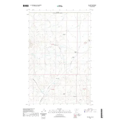
2020 Map of Fey Lakes
USGS Topo · Published 2020About this map
Gold Butte and the southern slopes of the Sweet Grass Hills define this high plains landscape along the international border in northern Montana. The terrain is characterized by a dense network of seasonal water bodies and named coulees, such as Dead Horse Coulee and Barnes Coulee, that drain toward the high-elevation basin. Numerous small lakes and named springs, including Fey Lakes, Swan Lake, and Ruby Johnson Lake, suggest a complex hydrological environment essential for the region's ranching economy.
Find a feature on this map
34 named features on this map. Tap any name to fly to it.
Don’t see what you’re looking for? This feature index may not catch every label — zoom into the map to look around manually.
Map Details
Editions of this 2020 Fey Lakes Map
This is the sole edition of this map. No revisions or reprints were ever made.
Other maps of this area

1945 · West Butte
USGS Topo · 1:62,500

1954 · Shelby
USGS Topo · 1:250,000

1958 · Shelby
USGS Topo · 1:250,000

1962 · Whitlash
USGS Topo · 1:24,000

1962 · Cameron Lake
USGS Topo · 1:24,000

1962 · Fey Lakes
USGS Topo · 1:24,000

1962 · Grassy Butte
USGS Topo · 1:24,000

1984 · Sweet Grass Hills
USGS Topo · 1:100,000
1986 · West Butte
USGS Topo · 1:24,000
1986 · Fivemile Coulee East
USGS Topo · 1:24,000