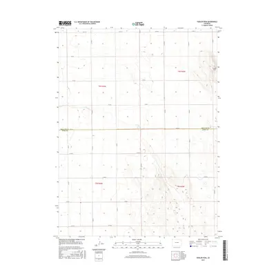
2016 Map of Fiddler Peak
USGS Topo · Published 2016About this map
Fiddler Peak rises as a prominent landmark in this section of the High Plains, situated along the border of Phillips Co and Yuma Co. The landscape is defined by a rigorous grid of section lines and county roads, reflecting the systematic land division of the American West. Intersecting the terrain is the ephemeral drainage of Patent Cr, which meanders through the southeast and northern portions of the quadrangle. The map documents a predominantly agricultural region where transportation is dictated by numbered routes such as Co Rd 60 and Co Rd 10. This 2016 survey illustrates how the fundamental structure of early 20th-century township and range surveys remains the primary framework for modern rural life and travel in northeastern Colorado.
Find a feature on this map
27 named features on this map. Tap any name to fly to it.
Don’t see what you’re looking for? This feature index may not catch every label — zoom into the map to look around manually.
Map Details
Editions of this 2016 Fiddler Peak Map
This is the sole edition of this map. No revisions or reprints were ever made.
Other maps of this area

1954 · Sterling
USGS Topo · 1:250,000

1958 · Sterling
USGS Topo · 1:250,000

1971 · Paoli
USGS Topo · 1:24,000

1971 · Holyoke
USGS Topo · 1:24,000

1971 · Fiddler Peak
USGS Topo · 1:24,000

1971 · Wauneta NE
USGS Topo · 1:24,000

1971 · Clarkville NE
USGS Topo · 1:24,000

1971 · Wauneta
USGS Topo · 1:24,000

1971 · Haxtun SE
USGS Topo · 1:24,000

1971 · Clarkville SE
USGS Topo · 1:24,000