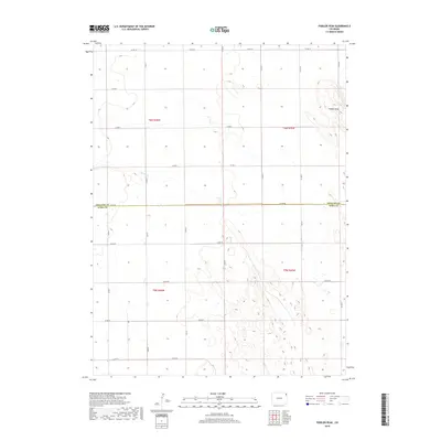
2019 Map of Fiddler Peak
USGS Topo · Published 2019About this map
Fiddler Peak rises as the primary landmark in this high plains landscape along the border of Phillips Co and Yuma Co. The terrain is defined by the ephemeral drainage of Patent Cr, which winds through the eastern portion of the quadrangle. The map captures a quintessential section of the American West's Public Land Survey System, shown by the rigid grid of county roads such as Co Rd 60 and Co Rd 10. This network of section-line roads illustrates the late 20th and early 21st-century agricultural organization of the region, where large-scale land management is dictated by the township and range system. The absence of concentrated settlements emphasizes the rural, open character of this part of eastern Colorado, where infrastructure is designed almost exclusively for transit between distant farmsteads and ranch lands.
Find a feature on this map
27 named features on this map. Tap any name to fly to it.
Don’t see what you’re looking for? This feature index may not catch every label — zoom into the map to look around manually.
Map Details
Editions of this 2019 Fiddler Peak Map
This is the sole edition of this map. No revisions or reprints were ever made.
Other maps of this area

1954 · Sterling
USGS Topo · 1:250,000

1958 · Sterling
USGS Topo · 1:250,000

1971 · Paoli
USGS Topo · 1:24,000

1971 · Holyoke
USGS Topo · 1:24,000

1971 · Fiddler Peak
USGS Topo · 1:24,000

1971 · Wauneta NE
USGS Topo · 1:24,000

1971 · Clarkville NE
USGS Topo · 1:24,000

1971 · Wauneta
USGS Topo · 1:24,000

1971 · Haxtun SE
USGS Topo · 1:24,000

1971 · Clarkville SE
USGS Topo · 1:24,000