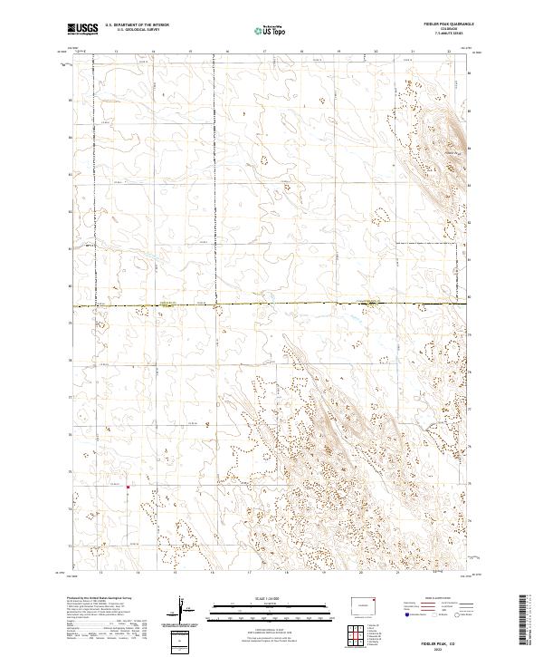
2022 Map of Fiddler Peak
USGS Topo · Published 2022About this map
The High Plains borderland where Phillips Co meets Yuma Co is defined by a rhythmic pattern of section roads and subtle drainages. This high-desert landscape is anchored by Fiddler Peak, a topographic rise in the northeastern corner that overlooks the surrounding plains. The terrain is carved by the winding course of Patent Cr, which cuts diagonally across the township lines. This area represents a classic example of the American Rectangular Survey System, where the grid of county roads, including Co RD 60 and Co RD 21, dictates the movement and agricultural division of the land. The mapping of t6n r46w and adjacent townships illustrates the expansive, open nature of Eastern Colorado’s rural geography.
Find a feature on this map
27 named features on this map. Tap any name to fly to it.
Don’t see what you’re looking for? This feature index may not catch every label — zoom into the map to look around manually.
Map Details
Editions of this 2022 Fiddler Peak Map
This is the sole edition of this map. No revisions or reprints were ever made.
Other maps of this area

1954 · Sterling
USGS Topo · 1:250,000

1958 · Sterling
USGS Topo · 1:250,000

1971 · Paoli
USGS Topo · 1:24,000

1971 · Holyoke
USGS Topo · 1:24,000

1971 · Fiddler Peak
USGS Topo · 1:24,000

1971 · Wauneta NE
USGS Topo · 1:24,000

1971 · Clarkville NE
USGS Topo · 1:24,000

1971 · Wauneta
USGS Topo · 1:24,000

1971 · Haxtun SE
USGS Topo · 1:24,000

1971 · Clarkville SE
USGS Topo · 1:24,000