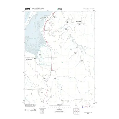
2012 Map of Fields Landing
USGS Topo · Published 2012About this map
Humboldt Bay and the tidal wetlands of South Bay define this coastal landscape south of Eureka. The community of Fields Landing serves as a primary hub along the eastern shore, while the South Spit separates the bay from the Pacific Ocean. This 2012 survey illustrates the complex intersection of maritime geography and inland ranching, with features like Bertas Ranch Bridge and Zanes Ranch Bridge crossing the Elk River. To the south, the Table Bluff Rancheria and the settlement of Loleta sit near the mouth of the Eel River. Researchers can trace local lineage at the Hookton Cem or identify old landing sites like Southport Landing. The map also captures the topography of Tompkins Hill and the numerous gulches, such as Railroad Gulch, that drain toward the bay's marshes.
Find a feature on this map
94 named features on this map. Tap any name to fly to it.
Don’t see what you’re looking for? This feature index may not catch every label — zoom into the map to look around manually.
Map Details
Editions of this 2012 Fields Landing Map
This is the sole edition of this map. No revisions or reprints were ever made.
Other maps of this area

1916 · Cape Fortunas
USGS Topo · 1:62,500

1922 · Eureka
USGS Topo · 1:62,500

1933 · Eureka
USGS Topo · 1:48,000

1942 · Eureka
USGS Topo · 1:62,500

1943 · Ferndale
USGS Topo · 1:62,500

1944 · Fortuna
USGS Topo · 1:62,500

1949 · Eureka
USGS Topo · 1:250,000

1951 · Eureka
USGS Topo · 1:62,500

1951 · Ferndale
USGS Topo · 1:62,500
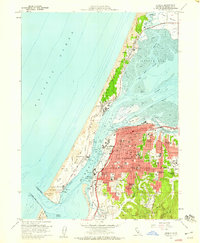
1958 · Eureka
USGS Topo · 1:24,000